BIRD ROUTES A) CAIRNS AND LOCAL AREAS WITHIN 15km
B) CAIRNS North West - KURANDA, MAREEBA, MT CARBINE, JULATTEN
C) CAIRNS South West - ATHERTON, MALANDA, YUNGABURRA, KABAN
A)SOME BIRDING LOCATIONS WITHIN 15 KMS OF CAIRNS + 2 Southern Locations
(To be used in conjunction with a good map of Cairns). Distances from the city ie. 6k NW = 6kms North West.
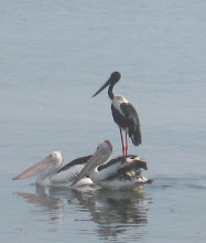
THE ESPLANADE - Mudflats - The area between Florence St and Minnie St, in front of the Tradewinds Hotel, is free parking and the best place to see the waders and other waterbirds. The peak times are Sept-Mar for the migratory birds. Best birding is when the rising tide is AT 1.8 metres (ie 2 hrs earlier than high tide of 2.4m).
THE ESPLANADE NORTH (2k N) - Mangrove edges - Mangrove Robins, Shining Flycatchers, maybe Beach Stone-Curlews.
CENTENARY LAKES (3k N) - Water/Parkland - Between Collins St and Greenslopes St is an extension of the Botanic Gardens. There is a saltwater and a freshwater lake separated by Saltwater Creek. A good mix of water and bush birds. Little and Collared Kingfishers, White-browed Crakes, Double-eyed Fig-parrots. 50 species in 2 hours is usually found by the local bird group which meets at 0630 on the 1st Sunday of the month on Greenslopes St 100m west of Saltwater Creek.
FREE BIRD trips each Tuesday morning. Meet 0830 at Botanic gardens office
MOUNT WHITFIELD (3k N)- Rainforest - A little steep in places. Adjoining the Botanic gardens in Collins St. Rainforest, grassy areas and woodland. Take the Red Arrow track to the start of the Blue Arrow track. Take the right hand track of the Blue Arrow until the rainforest area. Easy walk for 500m. Noisy Pitta, Buff-breasted K/Fisher, Lovely Fairy-wren, Superb/Wompoo Fruit Doves
MICHAELMAS CAY (28k E) A small sandy cay where some terns nest for most of the year. Usually 6-7 seabirds seen. Brown, Masked Boobies, Common Noddy, Roseate, Black-naped and Bridled Terns + Frigatebirds. "Seastar" carries less passengers, arrives first (thereby sees roosting birds before other boats get there). It stops at the Cay and allows landing for an hour or so. Be prepared for a long day if you are not into snorkelling.
AIRPORT AVENUE (3k N) - Mangroves - Two boardwalks provide access. Mangrove Robin, Shining Flycatcher, Collared Kingfisher plus honeyeaters at blossom time.
REDDEN ISLAND (8k N) - Woodland/Sandy Flats - Machans Beach. Go to end of Cinderella St. Park car and walk into the bush area on the west side of the street. Rose-crowned F/Doves, Lovely Fairy-wren. From car, walk to the beach and up to the mouth of the Barron River. At low tide, exposed sandbanks for waders, Beach Stone-curlew.
CATTANA WETLANDS (13k N) - Wetlands/Grass areas. Take Yorkeys Knob road and after 3 kms see Dunne Rd on left. Turn left and after 2 kms see roundabout. Take 1st exit left and park at gate. Walk in along bitumen for 5 mins to see 3 lakes. Jacana, Pygmy Goose, Crimson Finch and other grassbirds. The wetlands were opened on Dec 6th 2009. They are open at 0530 - 1930. The bird list is 140+ species
SMITHFIELD STW (13k N) - East end of McGregor's Rd, Smithfield. Park car at STW and walk along fence to see 2 sewage ponds. The eastern most pond is better. Water birds
YORKEY'S KNOB GOLF CLUB (15k N) - Lagoon - Go into Yorkeys Knob and just after the shops see Wattle St on the left. Follow this for 1 km and park in the shade next to the lagoon. Whistle Ducks, Glossy Ibis, Pygmy Goose.
SMITHFIELD CONSERVATION PARK (13k N) - Rainforest - At the West end of McGregor Rd, Smithfield see bike tracks to the right. Another entrance 300m north of McGregor Rd roundabout, leads to bike track area. Need 4wd for this 3 km track. Rainforest birds.
LAKE MORRIS ROAD (8k W) - Kanimbla - Rainforest. Cairns water supply in dam 15 kms along the road. Locked gate (2 kms before the dam) opens at 8.00 am. Plenty of good rainforest before that. Best birding after 8 kms. Stop to bird along the road. Monarchs, Fruit Doves, Pitta, Catbird, Riflebird, Boatbill.
STONEY CREEK (14k W) - Kamerunga. Rainforest. Park at the end of Stoney Ck Rd. Just over the bridge stay left for 2km easy walk or turn right to Douglas Track. Rainforest birds. Good swimming holes.
PORTSMITH STW (5k S) Kate St, 100m past railway line - Black/Fr Dotterel, Stilt, Whistle Ducks, Pied Herons.
EDMONTON (14k S) -End of Thomson Rd is the boat ramp. At low tide maybe Great-billed Heron plus other mangrove species.
EDMONTON - France Road (15k S) - Turf farm. Both sides of this road have produced Little Curlew, Pratincole, Buff-banded Rail and Grass Birds
CAIRNS CROCODILE FARM (18k S) - This location is now CLOSED to day visitors. It still operates as a crocodile farm. There is a commercial boat trip which includes a visit with its Trinity Inlet tour.
BEHANA GORGE (30k S) 5 kms past the Gordonvale traffic lights, see Behana Rd on the right(West). Drive to end of road and then walk. 3km service road reasonably flat walking. Rainforest birds. Good swimming holes.
GOLDSBOROUGH Rd (45k S) Turn right (West) at Gordonvale and take Gillies Hgwy for 7 kms and turn Left (South) on Goldsborough Rd. After 9 kms, park at bridge, end of bitumen. Walk up track for 2-3 k. Good variety of habitat on a gentle incline. Woodland, grass, rainforest.
B) SOME BIRDING LOCATIONS NORTH WEST OF CAIRNS VIA KENNEDY HIGHWAY, SMITHFIELD
BLACK MOUNTAIN ROAD - (Rainforest) - 11k past Smithfield roundabout and 2k past Rainforestation Tourist Area. Turn right (North). Rainforest birds. After 1k, at end of bitumen, concrete bridge. Platypus in this creek. From here, for the next 14 kms is good birding. Suggest 1st 5 kms only. Mackenzie’s Pocket, concrete bridge after 5 kms at the edge of exotic pine plantation, is a good spot.
KURANDA - Not a serious birders location, however there are good spots. Turn south at traffic lights and drive into this touristy village.
MT HAREN ROAD. - (Rainforest) - 1k past traffic lights see Warrill Rd. Turn right and then immediately left into Mt Haren Rd. This road ends after about 2k. Drive for 1k and park on right at entrance to Flying Doctor Radio Masts. Walk 500m down the bitumen road to the end. Walk near car and up to the gate.
WINDY HILL RD - (Rainforest) 3k past Warrill Rd turn left into Windy Hill Rd. Park after 300m. Worth 10 mins.
SPEEWAH ROAD - 2k more. (Woodland) Turn south and park after 30m and bird around the bridge. Lemon-Breasted F/Catcher. Continue over bridge for 1k in either direction for honeyeaters in gardens etc.
CLOHESY RIVER - 6k more. Turn south. Go for 8k to parking area. Rainforest area + boardwalk around figtree. Variety of rainforest and woodland species.
DAVIES CREEK - 8k more. (Woodlands) Turn left and go for 6k to camping area. 4wd may continue on road
EMERALD CREEK - 10k more. (Woodlands). Turn left. After 6k see water storage on left. Waterbirds. Continue for 5k and get to Emerald Creek picnic area. Walk up and down creek edges for Rufous Owl, White-browed Robin.
MAREEBA ROTARY PARK - On northern edge of Mareeba just before Granite Creek. Bush birds, some waterbirds.
MAREEBA WETLANDS - 7k north of Mareeba, at Biboohra. NB. This reserve is closed from DEC-MARCH (Wet Season).
The reserve is open every day from 0900 - 1630.
Turn left (west) into Pickford Rd and follow the signs. The main gate is 4 km down the road and there is good birding on the way down. Black Bittern at creek crossings and other dry-country birds, Squatter Pigeon, Great Bowerbird , Red-Tailed black-Cockatoo etc. Once through the gate drive 3k to the car park. Then walk to the Visitor Centre and see the attractions. There is a charge of $8 per adult to enter the reserve.
BIG MITCHELL CK - 14k after Biboohra, see Big Mitchell Ck. Just before the bridge, park on the east side. This is a regular haunt of the White-browed Robin. Jump into the creek bed and walk either east or west for this elusive bird. It is usually seen here.
LAKE MITCHELL - 700m past the Creek, see a gate on the left (west). The area between this gate and the gate 1k further down, is a stock route and birdos can enter. The areas to the left and right of the causeway are good for bushbirds and the lakes for waterbirds etc.
QUAID’S ROAD - 1k north of the lake Mitchell gate is a bitumen road on the right (east). This road is accessible for the first 7k. There are various ponds along either side of this road and these are good for Black-Throated Finches amongst others.
MOUNT MOLLOY - 12k more. Good area for Great Bowerbird in gardens.
RIFLE CREEK - 1k north of Mount Molloy is this camping area. Good birding along the edges of the bush and there is a track in the SW corner of the camping area which leads down to the creek.
Over the road, on the eastern side of the camping area is Wetherby Rd. After 4k is a lagoon. Always worth a drive on this road.
AFTER RIFLE CREEK BRIDGE KEEP NORTH FOR MT CARBINE. TURN RIGHT (EAST) FOR JULATTEN AND MOSSMAN (See Below).
LUSTER CREEK (10K) and STATION CREEK (4K) have tracks to the east. Both are worth a short stop.
MARYS FARMS - Halfway between Mt Molloy and Mt Carbine is Maryfarms. Either road to the east may turn up the Australian Bustard in the grassy paddocks.
MT CARBINE - Dry country woodlands plus old mining lakes. 500m north of the pub/service station turn left ( west) along a track to the lakes after 1 km. Waterbirds plus Babblers, Apostlebirds, Bustards etc.
AFTER RIFLE CREEK BRIDGE TURN EAST FOR JULATTEN/MOSSMAN.
ABATTOIR SWAMP (3k) There is a bird hide here and good native trees around the car park for honeyeaters.
KINGFISHER PARK (6k) - Australia's best known bird lodge. Either stay here or ask for permission to bird in the grounds. Small patch of rainforest with excellent variety of birds.
MT LEWIS - After 700m turn west, past the Tavern and keep left at the junction. Cross Bushey Creek and the clearing is about 12k. Good birding all the way. At the clearing (approx 1000m asl) there is a track to the left (west) which climbs gently. Excellent place for most of the endemics.
CARR RD - 400m A short road through rainforest and creek crossings.
Continue to the Capt. Cook Highway and turn north for Mossman and south for Port Douglas/Cairns.
C) SOME BIRDING LOCATIONS ON ATHERTON TABLELANDS, WEST OF CAIRNS VIA GILLIES HIGHWAY, GORDONVALE.
* Locations suggested for a day trip from Cairns.
*GILLIES TOP - 12K from Roos Creek at base of Gillies, park in small area on left. Woodland birds. Spotted Pardalote, Yellow-faced H/E.
*LAKE BARRINE - (Rainforest) 10k more, on the left. Park in top carpark. Excellent birding within 150m of carpark. Honeyeaters in gardens near buildings. Worth doing the short walk (600m) back to the 2 Kauri trees for Tooth-Billed Bowerbird (Oct-Dec).
LAKE EACHAM - (Rainforest) 6k past Barrine, turn left and follow signs. Good birding here near the parking/BBQ area and also the walk to the QPWS Ranger Office return.
*YUNGABURRA - 3k Drive around village for White-headed Pigeon, King Parrot and other garden species. The local boatramp (2k) is worth visiting for waterbirds but may be done on the return trip.
*MARKS LANE - (Paddocks) 5k past Yungaburra. Turn left and go for 3k and right for 1k to Gallo Park. Often good for raptors along this road.
*HASTIES SWAMP - (Waterbirds) Left for 50m and then right and follow signs to Hasties Swamp. There is a 2 level covered bird hide here. Always good for waterbirds but varies according to the water level. Brolgas and Sarus Cranes roost in evening (Oct-Dec).
WONGABEL FOREST (Rainforest) - Return to main road and turn right for 5k. Small area on left.
*MT HYPIPAMEE (THE CRATER) (Rainforest) - After 16k turn right into The Crater. Park at picnic area and walk around here. At 1000m altitude, this area has Golden Bowerbird, Mountain Thornbill and Atherton Scrubwren amongst others. The gully on the left immediately after the wooden bridge to The Crater, is known for Atherton Scrubwrens.
*LONGLANDS GAP SF 2k and park on left. Walk into clearing over the road and follow track into rainforest.
KABAN - (Woodlands - Northern limit for many Qld birds). After 4k take the Tumoulin Rd on the right.In this 20k triangle there are State Forest tracks and roadside habitat. Stop at any of these places.
After 6k turn right on Kaban Rd. Park after 800m, SF Gate on left after 500m, another after 700m (left) After 3K see level crossing. (Old Kaban Rd dirt road to right, leads back to Wandeclan and Herberton) Turn left on Kaban Rd for 1k (wetland), 500m Station Ck, and 2k to T-junction. Turn left ans see SF gates on right after 2k and after 500m. Return to Kennedy Highway and turn left.
* SPRINGVALE RD. (Woodland) Take the Herberton Rd, 2k south of The Crater and go for 8k and see Springvale Rd on the left. Turn left and after 500m turn left and go for 3k to park on right just past a creek crossing. This road passes via paddocks and a lagoon on left and mixed woodland. Walk to the right along the creek track for 1k. Fuscous H/E, Crested Shrike-Tit, White-cheeked H/E, Little Lorikeet, Brown Treecreeper, Dusky Woodswallow plus others.
*HERBERTON - Honeyeaters, parrots etc around town gardens.
MOOMIN RD. After 4k turn right. Fairly rough road. This road crosses a creek and leads to the Herberton water supply after 2-3k set in woodlands. Return same way.
*HASTIES SWAMP - After approx 10k see turn to Hasties Swamp or continue into Atherton.
No comments:
Post a Comment